About
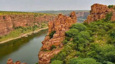
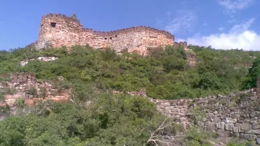
Gandikota is a village on the right bank of the river Penna, Gandikota area was first identified and made Sand fort in 1123 by Kakatiya Raja of nearby Bommanapalle village and a subordinate of Ahavamalla Someswara I, Kalyani Chalukya ruler. Gandikota came under the rule of Kakatiya dynasty from 1239 A.D to 1304 A.D and ruled by their various subordinates. Gandikota became the capital of Pemmasani Nayakas who ruled the fort and Gandikota region for more than 300 years. In 1652 A.D Pemmasani Timma Nayaka lost Gandikota battle with the attack of Mir Jumla, military general of Qutb shahi dynasty.
Gandikota then came under the power of Golconda sultanate and Timma Nayaka became their feudatory king.Mir jumla came into agreement with Pemmasani timma nayaka That He will be given Goooti(guti) fort if he agrees to leave Gandikota fort to Mir jumla and Even after the supporters of Timma Nayaka Said That Mir jumla may betray us, Timma Nayaka Didn’t listen to their words and agreed to the Agreement and left out the fort of Gandikota first with valuables and God Sculptures and jewelleries followed by Fort Women etc and Remaining were buried in the gandikota Fort itself…after leaving From Fort to Peta(Down Town).
Mir jumla Occupied the fort of gandikota and Send Agreement papers to Timma Nayaka by Altering it with the suggestion of his supporters As Renaming Gooti (guti) to “Hanumanagutti” Village of Once Kamalapuram Takuka (For Details Search google Hanumanagutti or HanumanalaGutti or Hanumaguru on Archives .org .Thus TimmaNayudu Duped. After the fort captured by Abdul Nawab Khan, it became the part of British India[citation needed]. Many families fled Gandikota to escape the persecution under the rule of Abdul Nawab Khan.
The village transformed into major fort after the emergence of Pemmasani Nayakas. Recently, Tavva Obul Reddy, a Mydukur-based historian, discovered a copper plate inscription on the history of Gandikonda Fort. The inscription dates back to 16th century. Vemana poet, native of Kadapa district and believed to have lived in Gandikota area for a short period. Jean Baptiste Tavernier visited the fort during his travel to Golconda sultanate.
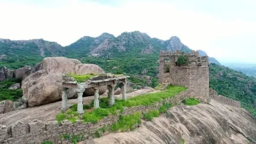
In the fort are two ancient temples, dedicated to Madhava and Ranganatha. They are in ruins and the fort area is full of the debris of ages and many ancient structures in varying stages of decay. The large granary, with a vaulted roof, is now used as watchman’s quarters. The Jamia Masjid has two adjacent minarets. A heritage festival is held every year in the fort area.[12]
The other structures in the fort, include another large granary (used for storing food and grains late back), a magazine, a graceful ‘pigeon tower’ with fretted windows and an extensive palace built by bricks with some plastered decorations and some wells. There is an old cannon lying in the fort. There is the ‘Rayalacheruvu’ with its perennial springs irrigating some lime and plantain gardens. It is said that this ‘Cheruvu’ was connected to a fountain in Jamia Masjid by pipes, traces of which can still be seen.
There were other gardens and springs. There is an undated inscription on a boulder, near the ‘Nagajhari’ outside the fort, recording the gift of two gardens at the place to the temple. There was a garden called ‘Parebagh’ with a waterfall at the foot of the hills, on the bank of the Penneru. There are multiple camping areas outside the Fort and on the banks of the Pennar river. The other main attractions at the fort includes House of the Drum (drums were used to alert the army in case of invasion), Charminar, Jail and Red Koneru.
Timings to visit
08:00 AM – 06:00 PM
Entry Fee
Free
How to Reach
By Air: Tirupati Airport – 228 km,
By Train: Jammalamadugu railway station – 17.6 km, Proddatur Railway station – 33.8 km
By Bus: Jammalamadugu Bus Statio – 15 km, Proddatur – 32.7 km,
Address
Gandikota, Gandikota Village, Kadapa District – 560037, Andhra Pradesh, India.
AP Tourism Official Website of Gandikota
Also Read Place To Visit In And Around Kadapa District
Gandikota Hotels Booking
Booking.com
Gandikota Map